I had just participated in my first ever cycling trek – ~100
km over 4 days in Leh as part of the Youth Hostels Association of India (group LMB9).
As satisfying as this was, I still had a lingering feeling of “some unfinished
business”. Perhaps a bigger adrenalin rush was what I needed and felt a ride up
to Khardung La (“La” is Tibetan for “Pass”) may just be it.
For those unawares, the road leading up to this pass is
claimed to be the “highest motorable road in the world”. While this claim may have without doubt been valid at some point in the past, it probably isn’t anymore.
(A pedantic discussion of this point is at the end of this post.) Hence, the
Border Roads Organization (BRO) signage at the pass that makes this claim may
have been true once upon a time and has simply not been updated. However, I have
no problem with this state of affairs because those who make it to the pass
revel, blissfully unaware, in taking their snaps standing in front of the said
signage and feeling happy (isn’t that the point of life?). Moreover, there is a
lot of satisfaction and perhaps a sense of some personal achievement against
the odds for the biker who makes it to that altitude, irrespective of any
superlative attached to that place.
Three options exist to make it up there: By four-wheeler
(4WD or 2WD), motorized two-wheeler, or bicycle. From what I heard from some of
the YHAI folks I met earlier, it is quite an exhilarating experience riding a
two-wheeler, especially if it is an Enfield Bullet™, to the top. For me though,
riding a bicycle fit my needs better.
I am neither a regular cyclist nor do I have much experience
in high altitude trekking or cycling. In the days immediately preceding, I had gotten
as high as 13450 ft. (bicycling with YHAI to Fotu La (this pass is the highest point between Srinagar and Leh on
the highway connecting the two), and 17688 ft. (by four-wheeler to Chang La on the way to Pangong Tso Lake
in Eastern Ladakh). Now, after a day’s rest from the YHAI tour, I wanted to
bicycle up to Khardung La @18380 ft. It was a less than ideally prepared leap
into unfamiliar territory as I was unsure about both the logistics involved (no
more YHAI to come to the rescue) and about how my body would cope with the ever
thinning air. (For a pedantic discussion about what exactly do people mean by
“thin air”, see the end of this blog post.)
Khardung La being a military post, there is no provision for
civilians to stay there. Hence, you’ll have to ensure that this is a day-trip
-- both legs of the journey need to be done and dusted during daylight hours. Riding
in the dark may be too dangerous and the weather may become too cold. There may
also be no passing traffic in case you need help. (Later, I suggest why you may consider doing at least a part of the
downward journey in the dark provided you are carrying artificial lights.)
A note about road surface conditions: At the time of my trek
(mid-Aug 2015), I encountered 3 types of surfaces: asphalt,
pavement foundation, and none (pictures below):
- The smooth asphalt road from Leh to South Pullu on the first leg of the upward journey was an absolute bliss to ride (especially on the way down).
- The road after South Pullu was still under construction where only the pavement foundation (before it receives asphalt) was ready. Barring the odd pothole, this surface did not offer any more challenge than an asphalt road would (well, that may not be entirely true given the greater surface friction that one would have to overcome).
- The paved foundation road had largely ended after a few kilometers (don’t recall how many) from which point on it was a “road” riddled with loose rock and tops of buried boulders jutting out, mixed in with some level stretches, interspersed by the occasional brook of snow melt. It was a bit uncomfortable riding this surface as it posed a higher risk of losing one’s balance (although any fall would not be a high speed one since you would be riding at a crawling pace anyways).
A few facts: Leh to Khardung La
- Elevation change from Leh town to Khardungla La: 6601 ft. (11483 ft. to 18380 ft.)
- Distance by road: 40km (but only 16km as the crow flies a.k.a. the great-circle distance)
Here was my experience. I managed to rent a suitable bicycle
the night before. Following a light sleep, I hit the road at 6:00AM. But, after
just 2 km, and 0 altitude gain I began to struggle which was probably down to
the fact that my body had not warmed up sufficiently and, frankly, nor had my
mind. But after reading two road signs that showed where I was heading, the
gears in my mind shifted and I started to make smoother progress.
 |
| A road sign just outside Leh town pointing out the way (to the right) to "Khardongla" |
 |
| The first BRO sign indicating where one is headed. |
Cycling for the first 2 hours on smooth asphalt road, I
managed to cover 20 kilometers (km). Distance remaining to cover? Just 20 more
km. You’d think I would reach the pass in another 2 hours (by 10:00AM). Wrong.
Excluding an hour for a lunch-cum-rest stop at South Pullu, it took me another
6 hours and 20 minutes to cover the remaining 20 km! In total, it took me 8 hours and 20 minutes of
riding time to get from Leh to Khardung La. Jeez! Google Maps estimates that in
2016 it would take a person 10 hours to walk that distance (1 hour by motorized
vehicle). A group journeying to this pass way back in 1900 state that it took
them 10 hours to march from Leh to the pass. (Although they did mount yaks from
the 14000 foot point. Cheeky. More on them later in the post.) In other words, someone
walking could have easily overtaken me while other bicyclists would have left
me far behind. Indeed, I came across a couple of riders at the start of my ride
whom I never once saw again. They were gone like the wind. There were at least
three other bicycle riders on this day (a foreign couple included) that I could
spot in the far distance behind me.
As I gained altitude the air started to thin out further, the
effect of which I began to feel the most from South Pullu onwards. There were
moments of agony (that’s perhaps too strong a word to use) showing just how poor
my cardio fitness level was. Furthermore, the cold at this height started to
bite despite it being a brilliantly sunny all throughout the day. I found
myself beginning to take far too many breaks to catch my breath. But the tough part
was to not know how much further I had left to go. Such knowledge normally acts
as a motivator. I had the opportunity to ask passing traffic for this
information, but chose not to. Instead, I made a mental guestimate (it turned
out to be some way off) and kept moving.
When I was about an hour away from the pass, I hit the
dreaded “wall”. I felt a bit too exhausted to go on and a slight bit
disheartened about not knowing how much distance I had left to cover. I was
also rationing water against my thirst. (Obviously, I had not filled up sufficiently
at South Pullu having underestimated the quantity I would end up consuming.) I
parked my bike and sat on a rock. Rule broken. I sort of zoned out for a few
seconds (which was a wee bit foolish and scary in equal measure as I was
sitting on the cliff side of the road) before finding my bearings again and
carrying on.
An hour later, I reached the pass. How does it feel? Like
almost all things in life, it is better left to be experienced. No words would
come near enough to describe one’s feelings; you must discover for yourself.
Personally, the tough surface conditions that I was lucky enough to encounter
made my ride all the more memorable than having to bicycle all the way along an
asphalt surface.
The views from the pass were nice. The road beyond descends into
the Nubra valley and continues along the Nubra river. In the far distance is the
Siachen Glacier (not sure if it is visible to the naked eye from Khardung La). Located at the pass itself are a small
military museum, a few commemorative plaques, and an operational café for those
in need of a hot beverage. There isn’t much else to the place. Moreover, it is
not recommended that you stay too long up there (30 minutes is the recommended
time) due to the thin air. Nor is there any accommodation to spend the night as
it is a military outpost.
Leave, you must.
Ride Summary:
- Start from Leh @ 06:00 hours.
- Half distance (20 km) covered in 2 hours.
- Lunch-cum-rest stop for an hour @ South Pullu (arrival time not recorded), the only inhabited place between Leh and Khardung La.
- Reached khardung La @15:20 hours
- Depart Khardung La @ 16:00 hours and reached Leh @ 18:15 hours
- 8 hours and 20 minutes: Total time (excluding an hour’s stop at South Pullu) but including a few 1 or 2 minute breaks along the way.
What’s the weather like at
Khardung La?
The undated note posted
inside the small museum at the pass sheds some light. Summer temperatures are a
balmy 20 degrees Celsius. However, in winters the pass experiences snow
accumulation of ~10 feet and minimum temperatures of minus 40 degrees Celsius.
While your average bicycling speed going up can reach as high as 1 km per hour
(!), wind speeds can reach up to 100 kmph. Despite such conditions, given the
security implications of these border lands, the pass is kept open round the
year by “men (and women?) and machines of 16 Border Roads Task Force
of Project Himank, Border Roads Organization”. Kudos to them.
A few things to consider
in planning a solo ride. Please bear with the mundane details:
1) Find a suitable ride.
There are many available on rent in Leh, even foreign brands (Giant™, Trek™,
etc.) The problem really is to ensure that you get functionally robust
equipment (no loose brakes, unreliable gear mechanism, grip-less tires, and the
like). Since I wasn’t too knowledgeable about these matters, it was important
for me to find a renter who is keen to make sure the equipment he is handing over
to me is in absolutely fit for the ride envisaged. You may be accommodative on
these criteria if you were renting a bike for joy rides around town but not
when you are undertaking a solo ride to a place where you are not going to find
support facilities in case of trouble. I was lucky to find a renter who was careful
and patient in ensuring I got a good bicycle.
a) It should be a mountain
bike. (I chose a Trek 3700.)
b) Lowest would be the
only gear you would likely use to go uphill (unless you want to challenge
yourself with the next higher gear). So, make sure the bike has no problems in
that gear position. You can shift to higher gears downhill, but be extremely
careful about the speeds you want to attain.
c) Carry a puncture kit. Some bicycle renters claim
that in case of any flats you just need to call and they will come and fix it.
However, I wouldn’t bet on it because: (i) it may take them too long to come
and consequently you may have to abandon your journey due to time constraints
(it may get dark); (ii) an unscrupulous renter will have no intention of
keeping his word; (iii) phones may not work so you can’t call anyone. The best
thing to do therefore is to carry a puncture kit. I asked for and took along
the following:
> a portable air pump (I ended up having to carry a
heavier full-sized pump rather as a palm-sized one as the latter was
unavailable);
> spare tube;
> screwdriver (not the sharp-edged, flat type that
may damage the tube but a blunt, “curved lip” one; see picture);
> knowledge: Learn how to fix flats and practice
it. With the right kind of mountain bike it should be fairly easy to
extract/mount the tire.
d) Obviously, ensure you
have safety equipment: Helmet, knee guards, etc.
2) Carry enough water but
not so much that you end up carrying additional weight than is necessary. Since
a liter of water weighs 1 kg, the lighter your equipment (the bicycle mainly)
the more liquids you can carry. There will be one place (South Pullu) on the
way where you can get a refill. So, plan accordingly.
3) Carry enough food/food supplements and packs of ORS
(oral rehydration salts). I did carry a few chocolate bars and fruits but underestimated the quantity I would end up consuming during
the ride. So, it’s better to err on the side of caution and carry more. In fact, choosing to carry energy bars/gels (such as by Cliff) rather than say fruits has the added advantage of being lighter in weight!
4) Carry some warm clothing. Though your body will be warmed by the physical exertion from cycling, I still suggest you carry warm clothing as: (1) the weather can turn on
a dime; (2) sometimes you may end up going so slow (either to conserve energy or
maybe you are unable to go faster) that your body doesn’t warm up enough so
that you don’t feel the cold around you (especially if it’s windy).
 |
| The rented equipment. |
 |
Hello friend. Will I
see you again in life? (Or will you see me again?)
|
 |
In memoriam.
|
 |
Lunch at South Pullu
|
 |
Asphalt road
|
 |
Pavement foundation road.
|
 |
A dark-colored mountainous outcrop south of the pass that
stands out in stark contrast to the surrounding greyness. Is possibly not basaltic
rock, what is it then?
|
 |
Construction workers toiling away near the pass.
|
 |
Ignoring the blue sky,
this place looked to me like moonscape.
|
Coda
While it took me 8.33 hours to go up, the ride down took a
miniscule 2 hours and 15 minutes. You can do it a lot faster if you do not plan
on stopping anywhere for photographs or to admire the scenery. I reckon that if
you don’t, you can come down in about an hour.
Tip: I suggest that you
make a biased tradeoff. For your adrenalin rush, speed all you want on the
smooth asphalt stretches. However, don’t do it too often and for long stretches
(like I did). Instead, allocate more time to stopping along the way to admire the
beauty of the sky, mountains, and a setting sun (the last one can happen if you
time your descent well enough). A compelling reason to do so is that, in my
opinion, on the way up your mind and body would be far too preoccupied with being
focused on the effort of riding the bike. Consequently, you would hardly get to
admire or appreciate much of the scenery while gasping for breath. So, reward
yourself on the way down.
Tip: I make this
suggestion to thus split your time on the way down because you only get one
shot (unless of course you want to again bike all the way back up.) There is
another way though. For your second trip to Khardung La, pop your bicycle into
a pickup truck, motor up to the pass, and then ride down, this time as often and
as fast as you can dare to. There are tour operators who will arrange for this
experience. (I didn’t try this).
 |
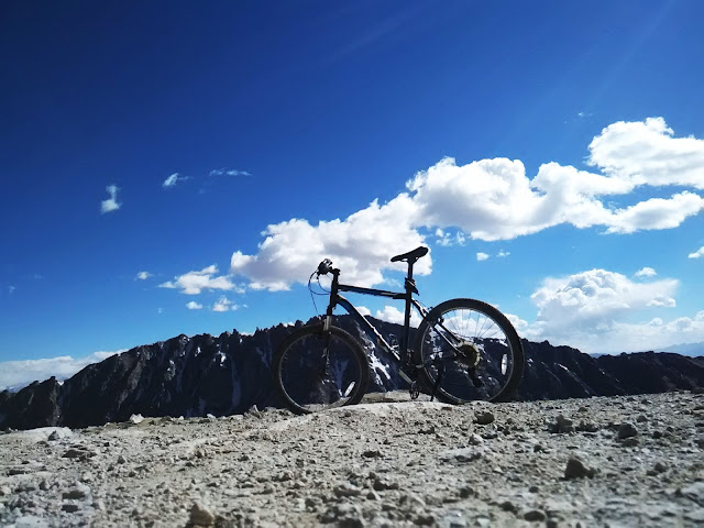
The bike at Khardungla Pass.
|
 |
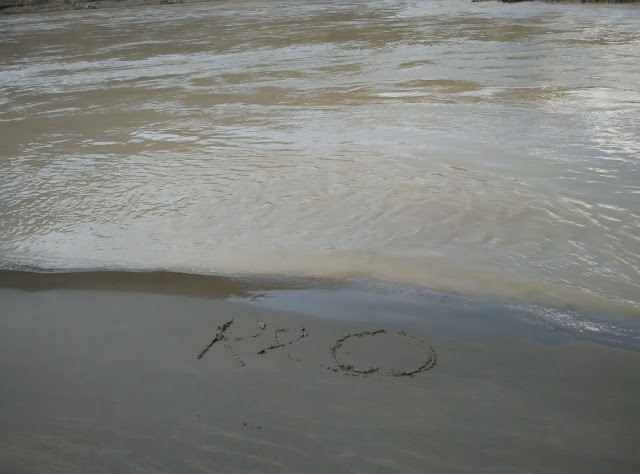
“RO”
|
 |
To date, 869 army personnel have laid down their lives for the country
while serving on the glacier, one of whom was Major N. Jawahar Reddy
<nda.nic.in/martyrs.html> of 2/8 Gorkha Rifles.
|
 |
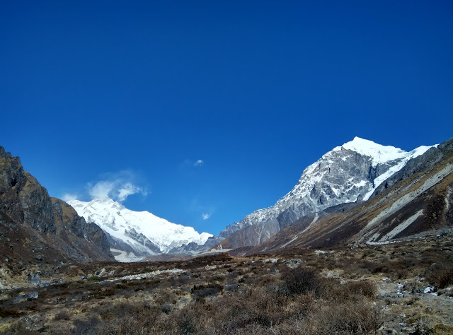
An astoundingly azure sky. Not artificially enhanced.
|
 |
On the way down.
|
 |
| On the way down. |
 |
| Shanti Stupa coming into view on approach to Leh town. |
 |
| Leh palace coming into view on approach to Leh town. |
 |
| A quaint little mosque glowing in the setting sunlight just as I enter Leh town. |
 |
A solo celebratory dinner in Leh town to mark the completion of a solo
ride.
|
For some perspective:
“World’s highest motorable road”? Which “world” are we on?
For a land of superlatives (world’s highest LPG bottling plant*, world’s highest research station**, world’s highest salt water lake***, world’s second highest astronomical observatory****, world’s highest battle ground^, world’s highest helipad^^, world’s highest airstrip^^^, world’s highest….phew!) there’s one causing a fair bit of confusion among readers and blissful denial ;) among riders and shutters bugs who make it there: The “world’s highest motorable road” (additionally complicated by how one defines “motorable”).
‘Ladakh’ literally means the ‘Land of many passes’ (pass = “La” in Tibetan). And so it is. Here are a few notable ones. Try deciding which is the “highest”:
- Marsimek La: 18635 ft. as per an undated note in the museum at Khardung La (unreferenced information on Wikipedia places it at 18314 ft.). It notes “…though higher than Khardung La, [Marsimik La] is not ‘motorable’ as it allows very limited move by four wheel drive vehicles over a rough track”. As of 2016, I am not aware if a pucca road has been laid or not. And, depending on how you choose to define “motorable”, this may well and truly be the highest in the world.
There's an insightful and informative write up about this pass on 60kph.com so no point in me commenting further not least because I have not been there (yet).
- Khardung La: 18380 ft. as per on-site BRO (Border Roads Organization) signage, else 17582 ft. as per a 2006 report by the Institut Cartographic de Catalunya (link for relevant documentation is on Wikipedia.) Interestingly, Fanny Bullock Workman, the mountaineer and cartographer, in her book ‘The Ice World of Himalayas’ mentions that “Kardong” was at a height of 17574 ft. (An extract from this fascinating book was posted in the aforementioned museum. You can also find it in the public domain at archive.org). She trekked across the pass way, way back in 1900. Do check out the Wikipedia page dedicated to her.
When I was riding on this road in Aug '15, work to resurface it with asphalt from South Pullu to Khardung La was ongoing. Those who rode it during this period (especially by motorbike or bicycle), you were lucky to have experienced a “tough” and therefore fulfilling ride. If the asphalt has since been laid, the challenging conditions no longer exist.
- Chang La: 17688 ft. (which doesn’t translate to the 5360m you will see mentioned on BRO signage at the pass! So, pick your number.) This pass is encountered on the road leading to Pangong Tso Lake. Asphalt road.
- Outside Ladakh:
Semo La: 18258 ft. in Tibet (China). Apparently the track is unsurfaced. Wikipedia uses the rather broad exegetic “highest vehicle-accessible pass” to describe it. (Source: Wikipedia).
*1180 ft. on the Srinigar-Leh highway;
**17582 ft. @ Chang La pass;
***Pangong Tso [I can’t confirm if it’s the world’s highest, but I can certainly confirm it tastes salty :)];
****14764 ft-based optical observatory @ Hanle as per Wikipedia;
^Siachen glacier where India maintains a permanent military presence @ over 20,000 ft.;
^^~21000 ft. @ Point Sonam as per Wikipedia;
^^^16614 ft. @ Daulat Beg Oldi (DBO). The DBO Advanced Landing Ground near the Line of Actual Control (LAC) is no doubt a gravel air strip but the Indian Air Force managed to land a gargantuan C-130J Super Hercules transport plane (wingspan of 132 ft., that's longer than a Boeing 737's at 111 ft.).
”Thin” air? Is dieting therefore better practiced in the mountains?
What exactly does one mean
by “thin “air? This was news to me: The percentage of oxygen in the air we
breathe in (i.e., inspired air) is constant (approx. 21%) irrespective of the altitude. What really matters therefore is the
atmospheric pressure, the weight of the air above us. So, obviously,
atmospheric pressure and hence inspired oxygen pressure falls (almost linearly,
allowing for variations in weather conditions) with altitude gain: 101kilopascals
(kPa) at sea-level, 50kPa at Khardung La, and 30kPa atop Everest (the latter
two are approximations based on the chart below). How this makes life difficult for us humans
is that the lower atmospheric pressure decreases the partial pressure of
inspired oxygen and hence the driving pressure for oxygen exchange in our lungs;
in other words, the decreased driving pressure of oxygen from our alveoli (the
air cells of our lungs) into the blood in our arteries insufficiently oxygenates
the blood. This’s just one of several problems your body will encounter. Enough
of the science lesson. For more information refer to this page on the NIH
website.
 |
| Chart showing the relationship between altitude and inspired oxygen pressure. (Sourced from Wikipedia) |
* * *
Thanks for your time reading through :)


